2004 08 09 Smoke Creek Desert, Nevada
2004 08 13 Nightingale, Jessup
2004 08 17 Nightingale, Lake Winnemucca
2004 08 18 Picnic Table, Derby Dam
2004 08 20 Alkali, Goldfield, Goldpoint, Weather
2004 08 21 Belmont, Big Weather
2004 08 23 Tonopah Airport, Coaldale
2004 08 17 Nightingale, Lake Winnemucca
Well, I was very happy to decide to try again to find Nightingale,
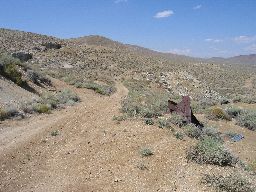
which I could not find a few days ago. This time I drove in a different way, from the southwest instead of the southeast. From the southwest you drive as if you are going to Pyramid Lake, and then at the town of Nixon (yes, Nixon) you head north past the Paiute Indian administration building along a good dirt road that winds south around the Sage Hen mountains and then north. The road climbs and climbs and is pretty good the whole way. And driving in this way you can't miss the mine and the remains of the town. (So the map book isn't wrong - it was me. I just did not go far enough last time..)
Anyway, here is the town and mine. It's a beautiful location. The sage smell was very strong in the sun. All that green stuff that runs out to the horizon is sage, and it seems to be flowering now. The flowers aren't anything to look at, but maybe they make the smell more intense. Or maybe it was just the sun.
 |
 |
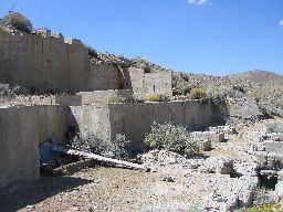
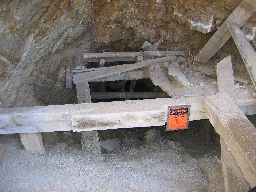
There had been a lot of machinery in this structure, but it's all been removed. You can see where large rotating machines must have gone.
 |
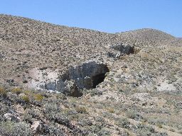
Some of the mines. This is not a profession I would choose.
 |
Another long view out to the east.
 |
One of the mines. I think I said this is not a profession I would choose..
 |
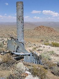
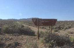
So this is the sign that I missed last time out here. There is a three way intersection here. I came in one way last time, a second way this time, and the third way goes to Nightingale. I never pushed on far enough to get to this sign last time. (This shot, and the next couple, have a very slightly soft look because like a moron I left a filter on this camera that I should have removed. Grr.)
 |
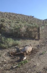
This is the Sage Hen Springs noted on the sign. Here's a horse (probably wild) that came for water and got his foot tangled in some of the barbed wire meant for the cattle. He had a long sad struggle. Some of his pals are watching.
 |
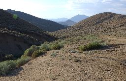
This is looking down from Lower Stonehouse Springs towards Lake Winnemucca. It's a beautiful place. It really felt nice to stick my hands in the cold water that filled a tank here.
 |
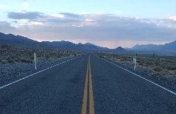
And finally back on pavement headed back south towards Nixon and I80, which is about 40 miles behind me as I look north here. Lake Winnemucca (off to the right in the photo) is now completely dry, but you can see beach lines all around. As recently as 30 or 40 years ago this lake held overflow from Pyramid Lake, but the "management" of the Truckee River via the Derby Dam (the Newlands Reclamation Project of 1905) has so diverted and regulated the flow into Pyramid Lake that Lake Winnemucca is no longer. At one point recently the lake was almost 90 feet deep. This diversion also dropped the level of Pyramid Lake almost 100 feet! The Truckee River has all of the problems of the Colorado River although on a smaller scale. It's a far smaller river, but like the Colorado, is utterly oversubscribed. The demands of farmers out near Fallon, the residents of Reno, farmers and ranchers in the Truckee Meadows area around Reno, and of Pyramid Lake and the Native Americans that regard the lake as sacred all contribute to demands on the river that simply cannot all be met.
 |